Manual of use of the program
1) Purposes of the program
The program designs to video and exports the file *.dxf of the world, of the state or of the states selected in the select projection and with the suitable parameters.For the states of Russia the data are in rectangular coordinates, they therefore am visible only through the Conic Projection of Lambert (Parameters not modifiable). Also for the Antarctica and Heard and McDonald Islands the data are in rectangular coordinates it therefore is visible only through the Projection Azimuthal Polar Stereografica (Parameters not modifiable).
30 projections, direct and inverse, are now available, the program is always in continuous amelioration
The spheroid for the data is Clarke 1866.
Orders of the program
2) Type of projection
You can select a Projection or modify the actual Projection
ATTENTION :When you convert the representation of a State or more States from
any type of Projection to the projection UTM the represented zone will be centered
on the central meridian
ATTENTION : With the Projections UTM and Polyconic you must to
remain
always near to the Central Meridian
List of the available Projections:
AZIMUTHAL
(1, 1)= "AZIMUTHAL Equidistant Projection"
(1, 2)= "ORTOGRAPHIC Projection"
(1, 3)= "GNOMONIC Projection"
(1, 4)= "LAMBERT AZIMUTHAL Equal-Area Projection"
(1, 5)= "STEREOGRAPHIC Conformal Projection"
(1, 6)= "POLAR STEREOGRAPHIC Projection"
CYLINDRICAL
(2, 1)= "MILLER Cylindrical Projection"
(2, 2)= "MERCATOR Conformal Projection"
(2, 3)= "EQUIRECTANGULAR Projection"
(2, 4)= "UNIVERSAL TRANSVERSE MERCATOR (UTM) Projection"
(2, 5) = "OBLIQUE MERCATOR (HOTINE A) Projection"
(2, 6) = "OBLIQUE MERCATOR (HOTINE B) Projection"
(2, 7) = "CASSINI TRANSVERSE Projection"
PSEUDOCILINDRICHE
(3, 1)= "ROBINSON Pseudocylindrical Projection"
(3, 2)= "MOLLWEIDE Equal-Area Projection"
(3, 3)= "SINUSOIDAL Equal-Area Projection"
(3, 4)= "WAGNER IV Projection"
CONICS
(4, 1)= "ALBERS Conical Equal-Area Projection"
(4, 2)= "LAMBERT Conformal Conic Projection"
(4, 3)= "POLYCONIC Projection"
(4, 4)= "EQUIDISTANT Conic To Projection"
(4, 5)= "EQUIDISTANT Conic B Projection"
(4, 6)= "BONNE PSEUDOCONIC Projection"
MODIFIED
(5, 1)= "HAMMER Equal-Area Projection"
(5, 2)= "VAN DER GRINTEN Projection"
(5, 3)= "WAGNER VII Projection"
(5, 4)= "OBLATED Equal-Area Projection"
(5, 5)= "GENERAL VERTICAL NEAR-SIDE PERSPECTIVE Projection"
INTERRUPTED
(6, 1)= "Interrupted MOLLWEIDE EQUAL-AREA Projection"
(6, 2)= "Interrupted GOODE 'S HOMOLOSINE Projection"
3) Graticule
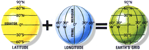
Fix the geographical grid fixing the angular ampleness between parallel and meridians, you can modify the grid of what it's represented to video.
01°= [deltalon]= 01° and [deltalat]= 01°
03°= [deltalon]= 03° and [deltalat]= 03°
05°= [deltalon]= 05° and [deltalat]= 05°
06°= [deltalon]= 06° and [deltalat]= 06°
10°= [deltalon]= 10° and [deltalat]= 05°
12°= [deltalon]= 12° and [deltalat]= 06°
For the representation of the world comes fixed to 10° and it's not modifiable
3a) Without
3aa) Parallels
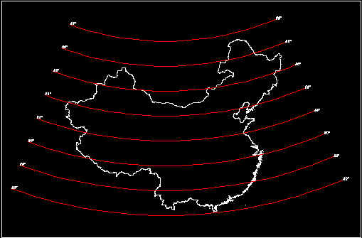
Parallels haven’t drawn

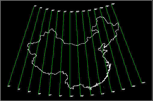
Conic Equidistant B Projection for China
3aa) Meridians
Meridians havent’s drawn
Conic Equidistant B Projection for China
When the Graticule has drawn , it’s possible eliminate parallels or meridians
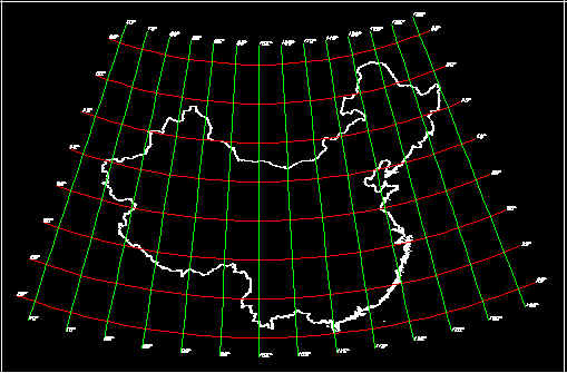
Conic Equidistant B Projection for China
4) File
4a) Open and Draw
4aa) States or Country
It allows you to design on the video the world or the State that comes selected
4ab) Add States or Country
It allows you to add on the video the State that comes selected, usually bordering with
that visualized.
The states of which you wants to develop the projection must not have a difference of
longitude > 180°
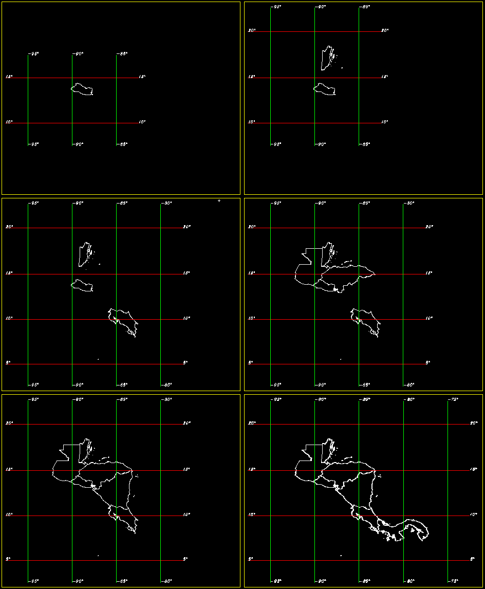
Mercator Projection for Central America
4ac) Graticule
It allows you to design the only grid of the select projection
4b) Clean and Restart
Restart the program
4c) End
It finishes the program
5) Parameters
5a) Origin of projection center
Fix the longitude and/or the latitude of the Center of Projection. For
many projection is possible modify
only the longitude. For the 2 interrupted projections the longitude is fixed to 0°.0000
and is not
modifiable. For the U.T.M projection. the program after have read the data fixed
automatically the
central zone of the State
It modifies the projection of the state to video with the new parameters.
Initially the values fixed for the Longitude = -3°.0000 and for the Latitude = 0°.0000 Zone = 30
5b) False East/ North
Fix the East coordinate and North of the center of projection, it
modifies the coordinates of the points
of the projection on the video according to the new data. For the U.T.M projection. the
coordinate
False East comes fixed to 500000 m. and is not modifiable, the coordinate False North
comes fixed to 0.
For the other Projections Initially the values fixed for the False East North are null
5c) Parallel Standard/ Parallels
Fix the values of the latitude of the parallel or of the standard parallels.
Values initially fixed for the varied projections:
Conic of Albers: 1st [parallel]= 20°.0000 2nd [parallel]= 40°.0000
Conic of Lambert: 1st [parallel]= 20°.0000 2nd [parallel]= 40°.0000
Conic Equidistant A: 1st [parallel]= 20°.0000
Conic Equidistant B: 1st [parallel]= 20°.0000 2nd [parallel]= 40°.0000
Bonne Pseudoconic: 1st [parallel]= 20°.0000
In the Conical Projection the graticule is projected :
1) onto a cone secant ( 1st parallel and 2nd parallel )
2) onto a cone tangent ( 1st parallel )
usually a mid-latitude parallel
5d) Oblated parameters
Fixed the parameters for the Projection Oblated Equal-Area
Coefficients of shape
ShapeM= 1.5
ShapeN= 2.4
Angle of rotation of the projection in radiant
ThetaObl= 0.000000
5e) General Vertical parameter
Fixed the parameter for the General Vertical Projection
HAboveS = 17250000 m
HAboveS is the distance from the plane of projection
5f) Hotine A parameters
Fix the parameters for the Oblique Mercator Hotine A Projection
Long1 = Longitude of the first point
Latid1 = Latitude of the first point
Long2 = Longitude of the second point
Latid2 = Latitude of the second point
The Great Circle defined by the tangent line formed by the sphere and the Oblique Cylinder is formed by the intersection of the spherical surface with the plane passing through these two points and the center of the earth.
5g) Hotine B parameters
Fix the parameters for the Oblique Mercator Hotine B Projection
Longi = Longitude of central point
Latitu = Latitude of central point
Azimuth = Azimuth of inclination of the projection
The Great Circle defined by the tangent line formed by the sphere and the Oblique Cylinder is formed by the intersection of the spherical surface with the plane passing through the central point and the center of the earth.
6) Export Dxf
6a) Dxf States or World without Graticule
You can export the file *.dxf of the state, of the states or of the
world in the select projection without
the grid
6b) Dxf Graticule
You can export the file *.dxf of the only Grid, if the select grid for the projection is (1,2) the file will be Grat1e2.dxf
6c) Dxf States with Graticule
You can export the file *.dxf of the state or of the states in the select projection with the grid.
For export the file *.dxf of the world with the grid click on 6a) and on 6b).
All the files will be saved in the directory of SetUp.
7) View or ( Right Mouse-Button )
7a) Enlarge
After have done this choice the menù will be checked, clikking on the monitor the draw will be magnified on the basis of the select scale factor (Factor+/).
7b) Reduce
After have done this choice the menù will be checked, clikking on the
monitor the draw will become smaller
on the basis of the select factor (Factor+/).
7c) Factor+/
Factor in [km] that determines as the draw becomes + or - big
7d) Zoom
7d1) All
It shows the State and the Graticule
7d2) Window
You comes magnified the zone framed on the monitor with this operation: mousedown on the first point of the monitor move the mouse up to the desired point and finally mousedown
7d3) Previous
It shows the previous image
7e) Pan
You comes move the drawing on the monitor with this operation: mousedown on the first point of the monitor move the mouse up to the desired point and finally mousedown
7f) Orthodromic Distance
You comes calculate and draw the Ortodromica between two points
with this operation: [mousedown] on the first point of the monitor move the mouse up to
the desired point and finally [mousedown]
The calculus of the Distance fails (Failed Distance) if the difference between the
longitudine1 and longitudine2 is> Pi ( 180° ) or the distance crosses the meridian
180°/ -180°
7g) Loxodromic Distance
You comes calculate and draw the Lossodromica between two points with this operation: [mousedown] on the first point of the monitor move the mouse up to the desired point and finally [mousedown]
Warning: move the mouse
slowly; the program couldn't understand
that the meridian +180°/-180° is being crossed
7h) Ellipse of Distorsion ( Tissot's Indicatrix )
It draws circles with 300 km of radius.
The centers are to interval of 12° of Longitude and 18° of Latitude.
Each circle is definite from points to interval 15° of which we calculate Longitude and
Latitude.
Subsequently we convert these points in X and Y on the interested projection. Uniting the
points
you'll have the circle or the ellipse that has the characteristics of deformation of the
projection
in the about of that point. If the indicatrix is a circle ( at a given point P ) then the
map is conformal,
( angle preserving ) at P , otherwise the main axes of the ellipse give the
directions of maximal and
minimal length distortion. If all the indicatrices, though they of different shape, have
the same area
the map is Equal-Area.
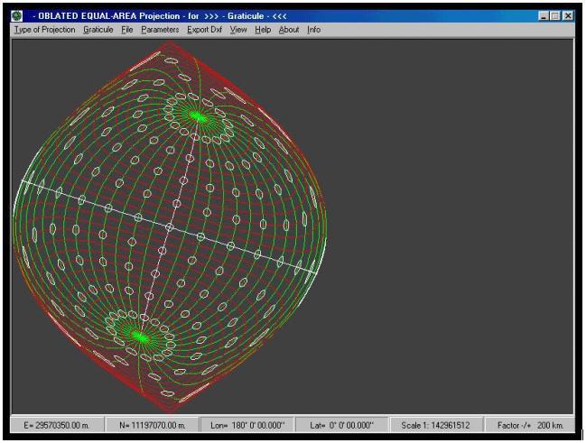
ATTENTION: Only for the Graticule / DeltaLon = 12° .
7i) Cities
Do you want to know where some cities of the world are found ?
You’ll draw all the cities of the states represented in projection.
In the file Cities.txt is possible to add all the cities that you want.
![]()
On the panels at low on the screen:
Panel 1) e 2) the coordinates E e N
Panel 3) e 4) the coordinates Lon e Lat
Panel 5) the scale of the draw to video
Panel 6) the zone in the case of the U.T.M Projection
Panel 1) the number of the Polygons of the State
Panel 6) the factor of scale in the case of enlargement and reduction.
Panel 6) Orthodromic o Loxodromic Distance ( km )
![]()

*** WINDOWS XP ***
![]() Download the Program atlas.zip
( 924 kb )
Download the Program atlas.zip
( 924 kb )
up-to-date
07/11/2008 ![]()
![]()
1) ![]() Download Ocx Files Library of VBasic 6.0 ocxfiles.zip
( 390 kb )
Download Ocx Files Library of VBasic 6.0 ocxfiles.zip
( 390 kb )
![]()
2) ![]() Download Files of Runtime VBasic 6.0 msvbvm60.zip
( 719 kb )
Download Files of Runtime VBasic 6.0 msvbvm60.zip
( 719 kb )
![]()
![]()