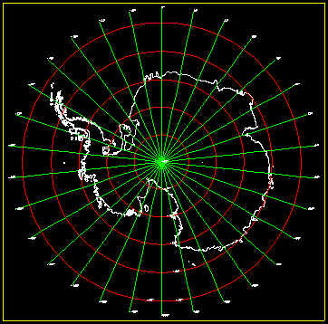
Polar Stereografic Projection for Antarctica

For the increase and diffusion of Cartography knowledge
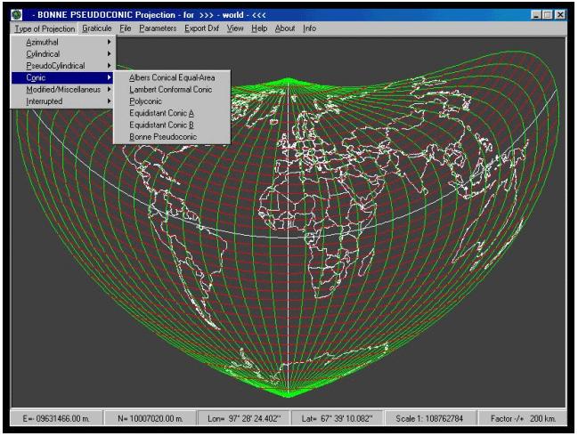
Cartography The Program Projections Maps
![]()
With the enclosed program atlas.zip you
can visualize the boundary of the states
of the world using one of the 30 Projections that I have just developed.
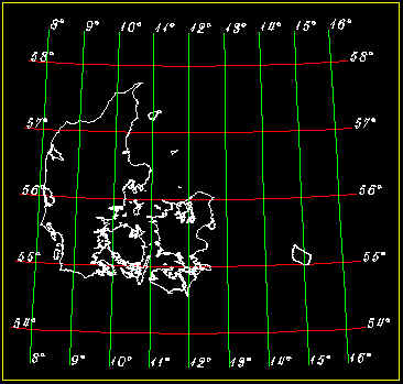
Lambert Conformal Conic for Denmark
![]()
The site is in continuous adjournment and
improvement.
It wants give a contribution to the knowledge of Cartography.
The data utilized from the program are ESRI
data. You can download them
at site of Pennsylvania University http://ortelius.maproom.psu.edu/dcw/
Sometime the site is unavailable to get the files , you have only to wait the restoration.
They're enclose in the program these files :
World (world2pts.txt)
Italy (italy2pts.txt)
Austria (austria2pts.txt)
Algeria (algeria2pts.txt)
The program's icon ![]() ® is the ESRI ® logo
® is the ESRI ® logo
I have used this image for thanks ESRI that has the copyright of the data and it
allows
the visualization of the States in the different projections.
The job has been done to didactic and educational purpose
The Program's SetUp doesn't modify any system's files,
read the installation file " ReadMe.rtf " in
atlas.zip ,
make a copy of the files ***.ocx less recent that they will be adjourned.
RECOMMENDED CONFIGURATION
Windows XP su Pentium III - 64 mb Ram
monitor 800x600 / 65536 colors 16 bit ( monitor 17" advisable ).
This version is intended for personal use only.
Public distibution or commercial use of this release is expressly prohibited.
Atlas.exe 1.1 may not be duplicated, sold or distributed.
Contact the author for comments and suggestions on this program.
Sorry for my English
![]()

Email : goodes@tiscalinet.it
This program has been developed by Prof. Ing. Diotallevi Gianfranco
Monte Roberto - (AN) 60030 - Pianello Vallesina - Via Trento 11
Teaching of Topografy and Cartography
currently in service by I.T.C.G. Cuppari - JESI - AN- Italy
Copyright © Ing.
Diotallevi Gianfranco
All rights reserved
Send your comments to : goodes@tiscalinet.it
Atlas 1.1 is Shareware
last revised 27-04-2013
Designed in 800x600 by Ing. Diotallevi Gianfranco - 2000/2001
![]()
Cartography The Program Projections Maps
![]()
![]()