|
|
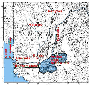
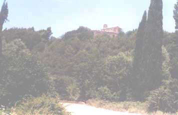
Photo from publication in reference 1 of bibliography |
|
|
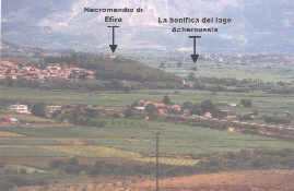
Photo from publication in reference 1 of bibliography |
The oracle of the dead, the
Nekromanteion of Ephyra, destroyed by the Romans at the end of the 3-rd
Macedonian war, rose on the top of a small hill near the confluence of
Acheron and Cocytus.
|
|
. |
Ancient Pyriphlegethon, another hell river, was, according to someone, the Cocytus tributary presently named Vouvos (see map above), according to others, was instead a tributary of the Acherousian lake, to be identified with the torrent Kakavas, now active in winter time only and observable from a bridge in the outskirts of the modern village of Kanalaki.
Certainly
you cannot but notice the impressive pieces of evidence that trace the
area in question back to the one described by Homer: Cape Cheimerion, the
three
rivers, the vegetation of poplars and willows,
the presence of an oracle, with the only difference that Homer does not
report the Acherousian lake, whereas very well described by Thucydides
(1.46. 3÷4) when he tells about the landing of Corinthians in the
bay of Ammoudia in 443 b.C., just before the naval battle against Corcyraeans,
off the Sybota.
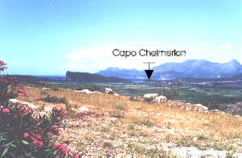 |
Ammoudia bay is the sheet of sea water
limited, on the one hand, by the rock spur at the centre of the photo,
on the other hand, by Cape Cheimerion you can just make out on the
right. According to the Greek grammarian Proteas Zeugmatites (3-rd cent.
b.C.), Cape C. would be named after Cimmerians,
which inhabited the beach in which Ulysses landed just before his descent
into the Hades.
Back to Ammoudia |