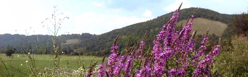
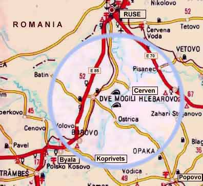
Territory

Koprivets is a small village situated in North Bulgaria on 43.44 latitude and 25.82 longitudes.
It is nestled in the foot of the low hills named Popovsko- Samuilski Visochini (with the altitude 220-296 meters above sea level), which separate the northern- east part of the country from the Danubian Plane.
The medium altitude of the village is 119 meters above sea level.

The village lies along the road wich connected the capital Sofia with the city of Varna on Black Sea coast (Sofia- Veliko Turnovo- Byala- Popovo- Shumen- Varna) .
Koprivets is 16 km away from Byàla, 34 km away from Pòpovo, 50 km away from Rousse, 55 km away from Veliko Tarnovo.


The surface of the village is 33 000 decars of forests and farming territories- orchards, vegetables, vineyards and other.
The relief is characterized by rounded low hills with an altitude of 220-296 m, and dry valleys.
The Baniski Lom river, an affluente of Russenski Lom river, cross the village.

Transport:
Follow the main road from Sofia to Veliko Turnovo.
In the entrance of Veliko Turnovo taking the northern road to Byala (Бяла), direction of Rousse (Русе).
Drive down the road,
past villages.
I
n the town of Byala pass a gas station (on your right).
Follow the road to the bridge with the monument of arch. Kolyu Fitcheto.

Please be careful and after passing the bridge turn right
following the signs to Popovo (Попово) or Varna (Варна)!
Riding another 16 km to the village of Koprivets (Kопривец).

Be very careful about observing the speed limit!

The speed limit in Bulgaria goes from 100 to 40 in the space of a couple of km, and the traffic police are all over the place.

Roads:

Right hand drive. Speed limits:
- residential areas - 50 km/h
- country roads - 80 km/h
- motorways - 120 km/h

home

© 2004-2008. Designed by Iskra Stoycheva
E-mail:
koprivets@libero.it