|
|
|
|
-
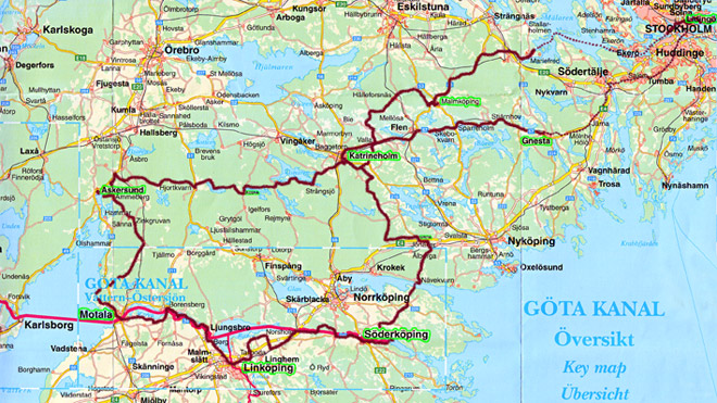
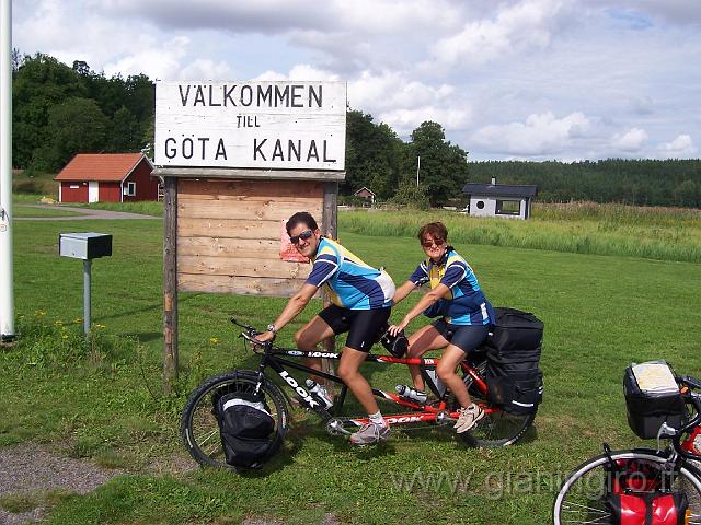
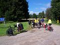
The Itinerary -
The
Gota Kanal tour comes up from Sven e Marie Bjorving's
travel agency Cycling
Sweden
in Katrineholm that, over this,
it suggests different cycling
holiday opportunities in the middle and southern Sweden
using the dense cycle tracks and the attractions that
this great nothern country offers.
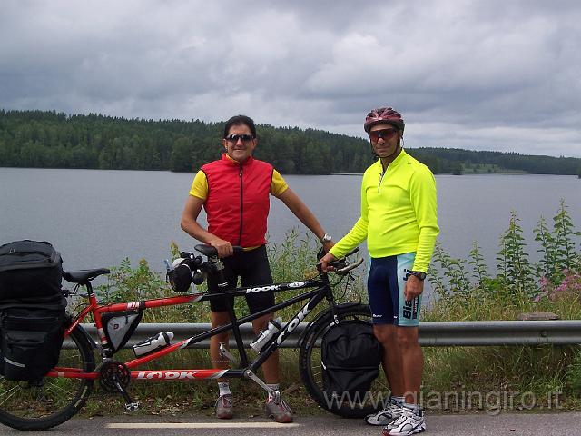
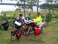
Flying from Italy, together
with our inseparable tandem and
with the help of our friend Flavio from Stockholm,
we decided to start our cycle raid just from Lidingo,
where he lives. We go
through the lake Malaren by a steam boat and, reached
Mariefred, we start in tandem towards Katrineholm
where together with other Cycling Sweden people (4
Americans and 4 Germans),
we start the Gota Kanal Tour that in seven days, going
through the Sormland and the Ostergotland countries,
it will brings us back to Katrineholm. But for us
it isn't ended yet. There is another long cycle transfer
to Gnesta, a trip by train to the central station
of Stockholm and the last 10 kilometers pedalling
to Lidingo. Not still tired, after a quietness day,
we start for the long and beautiful Stockholm archipelago
trip, that this 109 km and 1000 meters drop it will
keep us busy for all the day.
So, after 15 days under the clear nothern sky, we
take the fly and return in Italy. |
| |
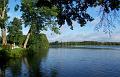
-
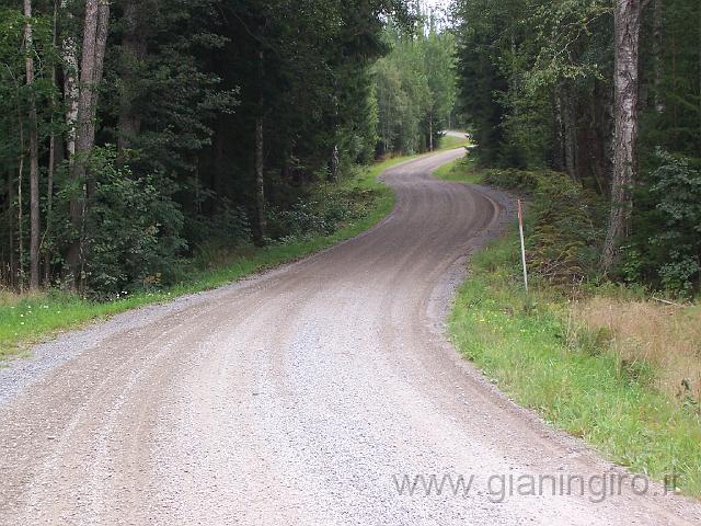
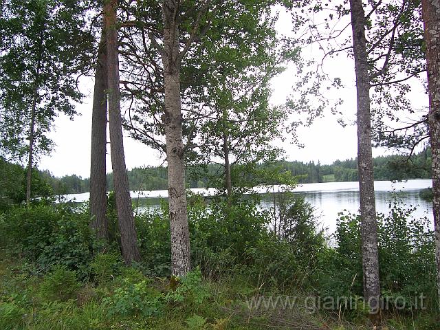
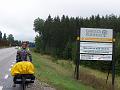
Sweden Cycle Paths-
-
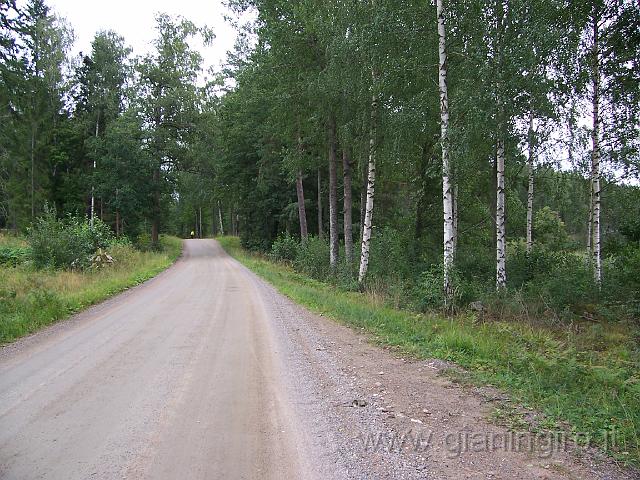
A dense system of cycle paths sign indicated, crosses
sweden territory specially in southern regions.
These cycle paths are only for bikers inside populated
cities or in particoular tourist places, otherwise
they use secondary few traffic roads.
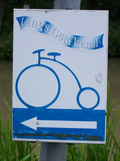
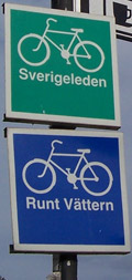
We'll follow some portion of 700 km of
Nackrosleden
cycle paths, a considerable
part of Langs Gota Kanal,
a little piece of 300 km of
Runt Vattern
and Sverigeleden
that with 6600 km is the longer cycle path and crosses
Sweden territory from South to North.
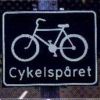
In the Stockholm archipelago track we'll often see
the
Kustlinjen
sign, that is the 565 km cycle path that follows
the eastern and southern coast of Stockholm Baltic
see, whereas Cykelsparet
is
the path that reachs Finland by the Botnian bay
side.
|
|
|
|
|
| -
Travel Logistics -
- How to arrive in Stockholm -
-
To arrive in Stockholm from Italy, the best solution
is air.
For us, that we shold carry our tandem, it was a
little more complicated.
Taking into account that the
intrusion of our luggage (100 x 190 x 30) the only
more secure solution was using the SAS company that
from Milan Malpensa reaches Stockholm stopping over
Copenaghen.
To avoid the undesiderable inconvenience of not
find our luggage at Stockholm arrival we advise
to not take the first flight following the call
in Copenhagen, but leave at least 2 hours as time
for a correct transfer luggage from a plane to the
other.
- Packing and Shipping Baggage-
-
It is important to care the packaging. The simple
cardboard in not enough. Especially the exchange
and the toothed wheel of our tandem that in the
departing travel took hard blows risking of shatter
our holiday. The bags cost too much and if they
are not rigid protect too little, the best solution
is to use panels of polystyrene of at least 3 cm
and to wrap everything with a couple of layers of
pluriballand then forge strong the package with
tape for packages.
Having not usual dimensions,
just made the check-in, the tandem is delivered
separately from other baggage in the section "luggage
outside measure" that is in all the airports.
|
| |
| -
FROM LOGBOOK: OUR 10 STAGES- |
|
|
|
-
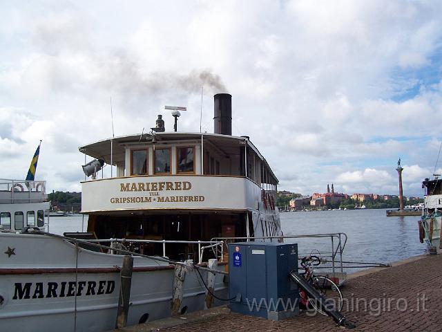
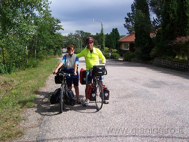
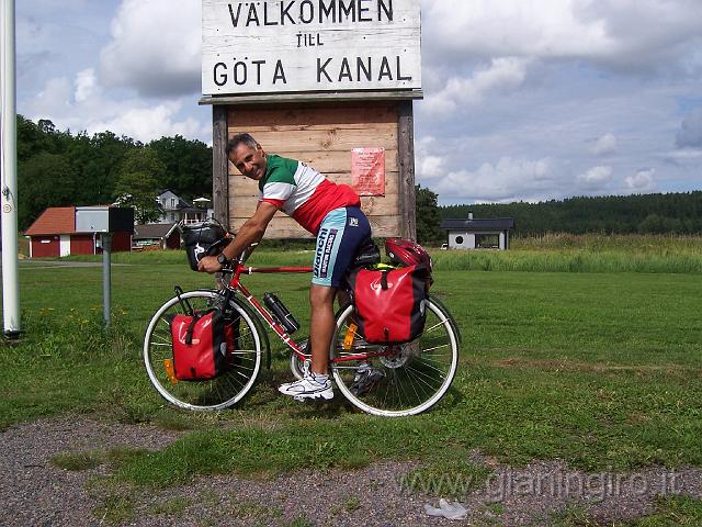
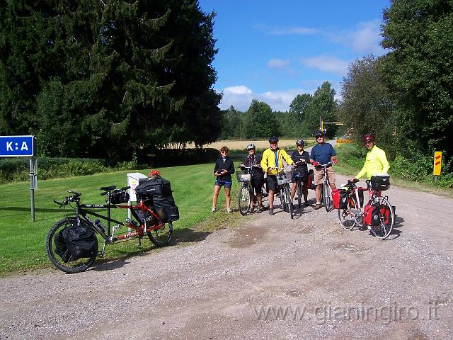
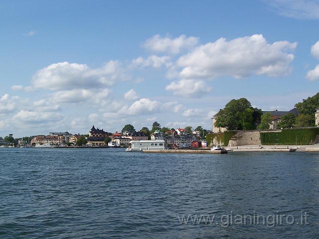
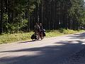
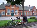
Saturday 9 August 2008 - the 1st stage:
Lidingo - Stoccolma + battello + Mariefred - Malmkoping
Departure
with sun and thundery in the afternoon
Leaving Flavio's house at
9, 00 a.m. with sunny and cool breeze we move towards
the centre of Stockholm on port of the lake and
at 10.00 o'clock we embark on the steam boat to
Mariefred. After 61 Km of navigation, at half past
one we arrive in the small Mariefred harbor.
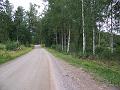
On cycling path through woods
and lakes we move into Akers Styckebruk and to Soderlanna
we left on the road 55. Near Bjorndammen, invested
by a heavy thunderstorm, we find shelter under the
canopy to a garage. After half an hour we return
again to cycling for go last 15 km to reach the
Hotel Plevnagarden of Malmkoping.
|
|
| |
| |
-
Sunday 10 August 2008 -
the 2nd stage:
Malmkoping - Katrineholm
Cloudy and cool
Departure from malmkoping at
9.10 a.m., after having turned in country in search
of the road to follow, we take one dirt road in the
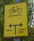
direction of Smedstorp. Here we meet the yellow and
black Nackrosleden
indication that we follow and between forests and
crops, in continuous ups and downs, we cross Halleforsnas.
Before reaching Valla, we pass the 57 Highway and
continue to the Nackrosleden
up to Forssjo, then we go up the last 10 km to the
Hotel Duveholm Herrgard of Katrineholm.
|
|
|
| |
-
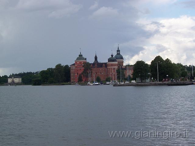
Monday 11 August 2008
- the 3rd stage:
First
stage of the Gota Kanal
tour
Katrineholm - Vreta
Km 48 on the track (for a mistake we carried out
60 km) Sunny in the morning, thunderstorms in the
afternoon
After
taking the trip informations from Mr Sven we leave
Katrineholm at 10.00 a.m. At the exit of the hotel
we take a cycling path up to Forssjo where we take
the Nackrosleden
that turn us away from inhabited
world and enters in a thick wood.
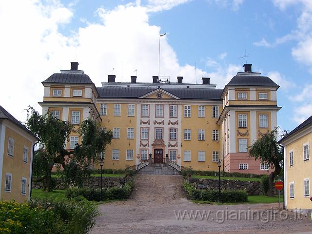
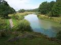
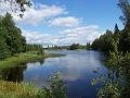
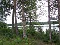
Reached the lake of Eriksberg, crossed the castle,
we opt for the cycle of right that Mr. Sven has
indicated as the most beautiful and panoramic.
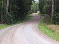
After a few km in gravelled road the path continues
on asphalt between forests and crops of cereals.
After Bjarsatter our
route shall meet the other cycle path that after
the castle turned left going through Bjorkvik.
Now Nackrosleden
shall proceed between forests
and farms with a series of continuos ups and downs,
it exceeds the Enaren lake and the village of Vira.
It's half past 12.00 pm when
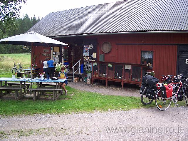
we stop to eat near Sandstugan. Interrupted by a
sudden thunderstorm we continue our path and, in
our enthusiasm, we don't see a marker that indicated
to turn left and that would have brought us to the
hotel in two kilometers. Doing wrong we proceed
straight through under the highway E4 until we cross
the highway. We turn right and, under another thunderstorm,
we reach Stavsjobruk. Found shelter and information,
after the magical coffee prepared by Flavio and
with a shining sun, we reach our hotel to Vreta
(. our mistake cost us a storm and an
extra path of 12
Km).
|
|
|
| |
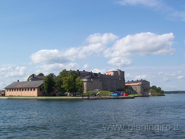
-
Tuesday 12 August 2008
- the 4th stage:
Second
stage of the Gota Kanal
tour
Vreta - Soderkoping
Sunny and windy
We
leave Vreta at 9,15 am after the usual abundant
breakfast in a windy and sunny morning. Following
the Nackrosleden
after a couple of km on the highway we turn right,
going over an uphill and overcome Alberga.
We continue along on the tarmac
road the Nackrosleden
we reach Kvarsebo and a great
fjord on the Baltic Sea that we follow for a couple
of Km towards right until the
free ferry that connects the continuation
of the road to the south.
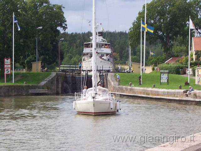
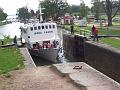
After the ferry, our challenge
will be fighting against a hot sun and a strong
wind against to our direction more than 20 km crossing
Husby and Kuddy. A
km after Kuddy, the Nackrosleden
turns left in a gravelled
road towards Mem. Over
the castle, we descend
on the shore of the sea with a beatiful beach point
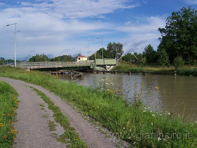
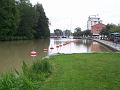
where the Gota Kanal leads in the Baltic Sea. The
time to eat something and for a good coffee, taking
some photos at the lock, and we follow the new cycle
path "Langs Gota Kanal"
until Soderkoping.
|
| |
| |
|
|
| -
Wednesday 13 August 2008
- the 5th stage:
Third
stage of the Gota Kanal
tour
Soderkoping - Linkoping
Km 55 on the track (for a mistake we
carried 67 km and 300 md) Sunny and
windy
Leaving Soderkoping we take
the Langs
Gota Kanal
until the banks of the lake Asplangen that we skirt
on the right side between holiday villages and woods.
At the end of the lake leaving
the wood we catch again the
Langs Gota Kanal.
We stop for a refreshment
on the staging point of Brattom. In Norsholm we
divide and leave the kanal that enters the lake
Roxen, we cross the rail and follow the asphalt
cycle path that crosses Backeby, Lillkirka, O' Skrukeby.
To Asplorpet we don't see the indication for Linghem
2 where we should have turn for Rystad and continue
towards the North. Not seeing more cycle path signs,
we cross award Bjursbi and Distorp to reach the
town of Linkoping after extending the path of 12
km.
|
| 
|
| |
| |
-
Thursday 14 August 2008
- the 6th stage:
Linkoping - Motala
Fourth
stage of the Gota Kanal
tour
Cloudy weather, rain and strong winds
At
8,45 am we leave the Scandic hotel of Linkoping and,
under a cloudy sky that threat
rain, we take the cycle path that leads us to Berg.
After a little stop at the monastery,
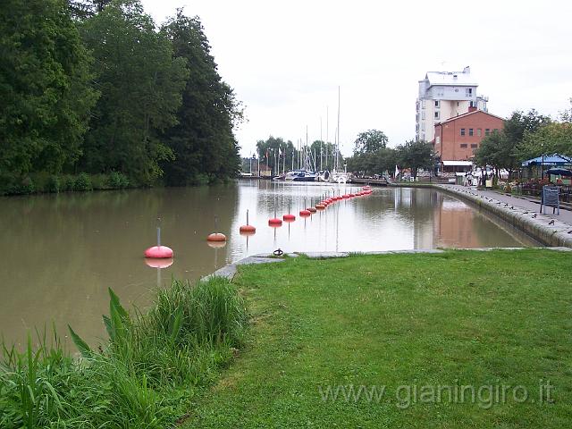
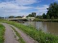
let's take the Gota kanal. It is here at Berg that,
with a series of 7 locks, the channel raises the vessels
of 36 metres from the level of below Lake Roxen. We
follow the track on the channel up to Borenberg where
a thick rain with strong gusts of wind side will accompany
us on the section of Sverigeleden
up to Motala. We come to the
hotel "M" in the town on the banks of Vattern
lake at 02,30 pm with a clear sky and a very strong
wind
|
|
|
| |
-
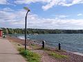
Friday 15 August 2008 -
the 7th stage:
Motala - Askersund
Fifth
stage of the Gota Kanal
tour
Beautiful weather and wind to favour
The
days they run fast as the clouds in the North skies,
as the kilometers under our weels.
As planned, the strong wind
that blows from the South-West and that yesterday
it slowed our march, today that we move towards the
north it give us a strong thrust as we rise considerably
the average speed.
We start to 8,30 taking the
new cycle on asphalt from the blue cartel
Runt Vattern that
initially runs along the lake Vattern for then point
towards north-east up to Godegard.
Now it begins a beautiful gravelled
road towards the North-West and that crosses the minig
village of Zinkgruvan in a beautiful scenery of woods
and lakes. Our cycle path will return on asphalt a
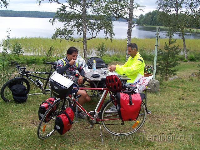
few km before Ammeberg. We consume our meal on the
shores of Lake Ammelangen before doing the last 10
km that separate us from Askersund, that we reach
at 02,30 pm.
|

|
|
| |
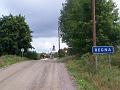
-
Saturday 16 August 2008
- the 8th stage:
Askersund - Regna
Sixth
stage of the Gota Kanal
tour
Cloudy in the morning then variable
We start at 8.50 am under a
cloudy sky and with a little fog. We take backwards
the cycle path travelled yesterday until Amme. We
turn left along the highway and follow up to Angermanland
where we turn right towards Ronneshytta following
the green sign of Sverigeleden.
In
Ronneshytta, following the cycle path, we left on
a gravelled road. Now start a long stretch of road
through the woods and lakes, exceed the villages of
Galsjo, Svaldre, Narkesberg and Haddebo until we cross
hightway 51. We left and after 1,5 Km of road we turn
right towards Bo. We
leave Sverigeleden
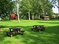
turning right. After about 4 km we stop in a pic-nic
area in the lakeside Avern (the cartel indicates"badplats"
on
the right side)
for the usual lunch. A short rain advise us that we
have to go, so we start and arrive in Regna at 01.50
pm in the sun.
|
|
|
| |
-
Sunday 17 August 2008 -
the 9th stage:
Regna - Katrineholm
Seventh
stage of the Gota Kanal
tour
Cloudy weather
This is the shortest stage of
our tour, let's use it for starting later.
At 09.15 we leave the Hotel
Regnagarden under a cloudy sky and with temperature
of about 15 degrees. Returned to the junction with
the highway we turn right toward Odestorp and about
1 km turn left again to Regnaholm and Havlagard following
the Sverigeleden
on a dirt road. At the crossroad of Havlagard we turn
left on asphalt for about 1 km to Havlabruk. At the
next crossroad we turn right following the indications
for Katrineholm, Sverigeleden
and Nackrosleden.
Carry on to Katrineholm
where we'll find the Hotel Duveholm Herrgard that
we leaved a week ago.
|
|
|
| |
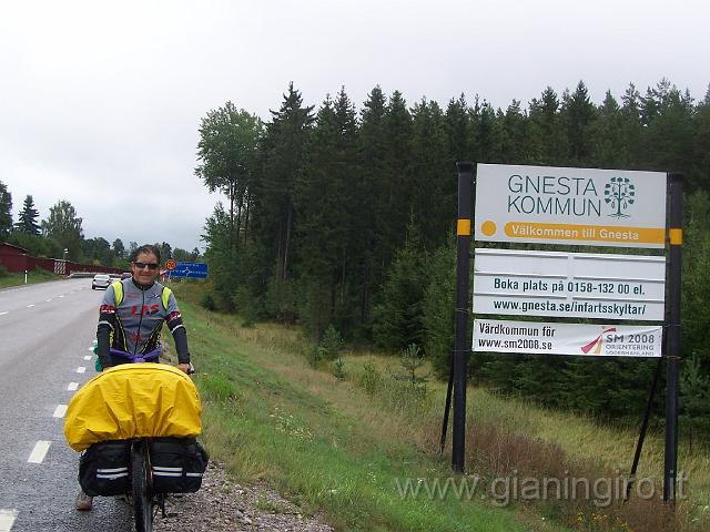
-
Monday 18 August 2008 -
the 10th and the last stage:
Katrineholm - Gnesta + treno + Stoccolma - Lidingo
Cloudy and rain
Unwillingly
we leave Katrineholm and the Duveholm Herrgard Hotel
at 08.30. The
sky is cloudy and there are 17 degrees when we start
for this last transfer stage.
Following highways 55 to Flen
and 57 to Gnesta we cross from West to East all the
Sormland Country. At 12.30, sodden from the frequent
rains, we arrive to the Gnesta Train Station. It's
a pity to see so a beautyful place with the bad weather.
After having eaten and
refreshed we take the train to Sodertalje, the we
take another one to that it will bring us to the central
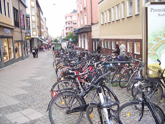
station of Stockholm that we reach at 15.30.
The last
10 km cycling to cross the city and reach Flavio's
house in the quiet island of Lidingo.
So we have finished our long
journey between the regions of Sormland and Ostergotland
lasted 10 days cycling for 627 km with 4000 meters
of drop.
|
|
|
| |
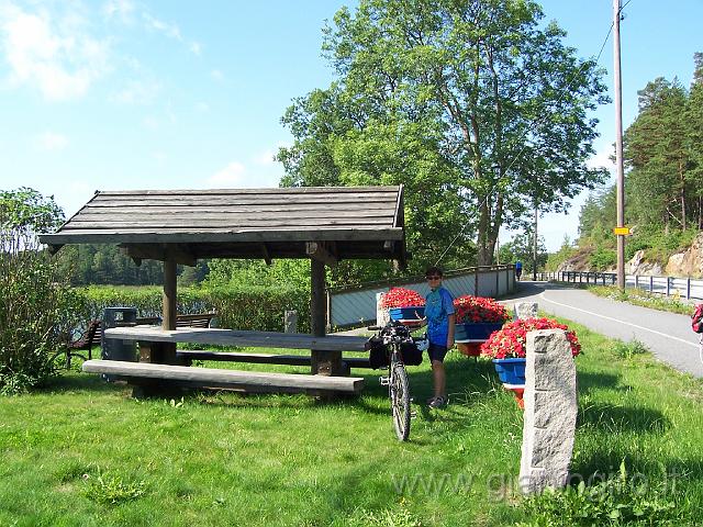
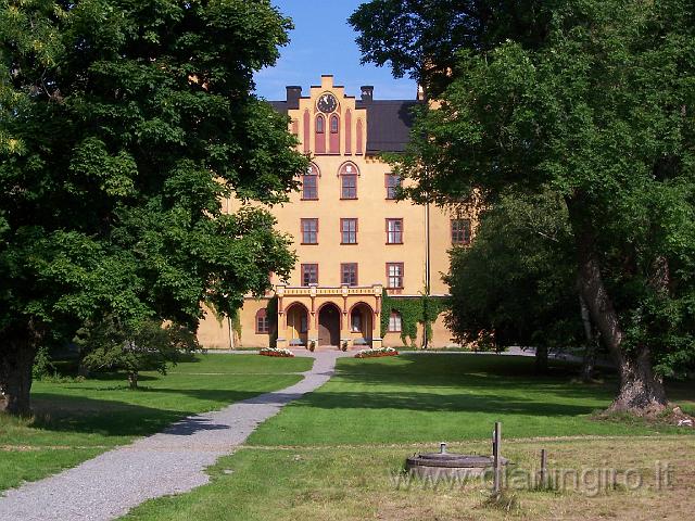
-
Wednesday 20 August 2008
-
Out of programme: The
Stockholm Archipelago tour
Sunny and warm weather
Only a day after the end of
our raid we already want to return to pedal.
Flavio has prepared for us a
ring route through five island of the great archipelago
in the east of Stockholm.
So we
start at 09.00 from Lidingo to the South, crossing
the centre of the city and then on cycle paths up
to take the Varmdovagen that, to the east exceeded
Gustavsberg, it will bring us to the Varmdo island.
We'll follow Varmdovagen (Highway
274) to the North, overcoming Torsby, Angsvik and
Siggesta Gard untill to reach the port of Stenslatten
where we'll take the ferry to Rindo island.
Let's take the 274 that, for
the distance of 6,5 km, crosses the island and ended
at the second ferry to the beautyful island of Vaxholm
with its pleasant town which overlooks the Baltic
sea.
In Vaxholm we'll stop to eat.
The sun beats strong and there are 25 degrees when
we start in the Stockholmvagen (Highway 274). After
few km we turn left crossing a bridge and following
Bogesund indications. A secondary road between forests
and lakes leads us to the beautiful castle of Bogesund
before to rejoin to the usual Highway 274. Exceeded
the bridge of E18 Hyghway, We descend to the South
and by cycle paths, crossing Taby and Danderyd, we
found the indications for Stockholm and Lidingo that
we'll achieve in the late afternoon.
|
|
|
| |
|
|
| Copyright
© Gianingiro.it - 2002 / 2011 |
|