

Credit to DigitalGlobe http://www.globalsecurity.org/wmd/world/syria/al-safir.htm
 |
 |
| Home >> WMD >> World >> Syria >> Facilities >> |
| Credit: DigitalGlobe. Copyright (c) DigitalGlobe. All RIGHTS RESERVED. Contact DigitalGlobe for media permission or purchase at 1-(800) 496-1225 or info@digitalglobe.com | ||||
| Imagery of Al Safir |
|
|||
| Click on the small image to view a larger version | ||||
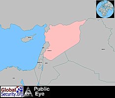 Overview of the Middle East with Syria in the center |
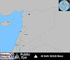 Al Safir SCUD Base and Weapons Depot, Syria |
|||
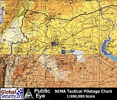 Tactical Pilotage Chart with NIMA CIB imagery overlayed showing the general location of the Al Safir SCUD base |
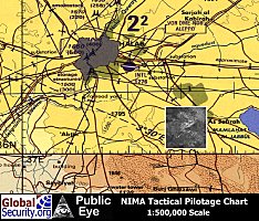 Tactical Pilotage Chart with NIMA CIB imagery overlayed showing Al Safir |
|||
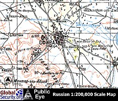 Russian 1:200,00 Map of the Al Safir chemical weapons plant and storage area as of 1980. |
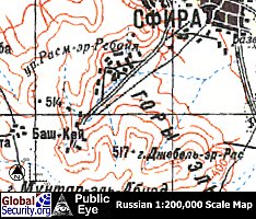 The CW plant and storage area in the western canyon are visible. The munitions storage area would not be detected until 1987. Work on the underground SCUD base would not be visible until 1995. Completion of the Tunnel complex and the SCUD support base was detected in the July 2002 Digital Globe image. |
|||
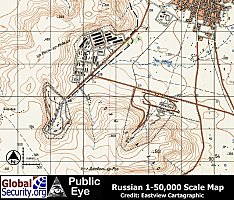 Russian 1:50,000 Map of the Al Safir Scud base as of 1987 |
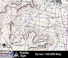 Syrian 1:50,000 Map as of 1994. The omission of the facility from the Syrian government's map is a sure indicator that the facility is of military nature. |
|||
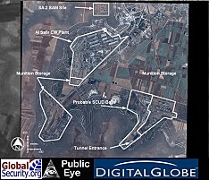 Digital Globe image taken on 30 July, 2002 of the Al Safir CW plant and SCUD base. Al Safir is protected by an SA-2 SAM battery. |
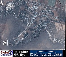 Overview of the probable SCUD support base and underground facility. A munition storage area lies to the right. |
|||
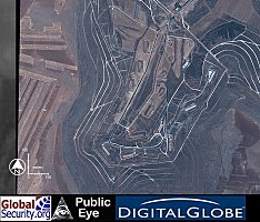 Close-up of the munitions storage area. Additional storage bunkers have been added between 1987 and 1995. |
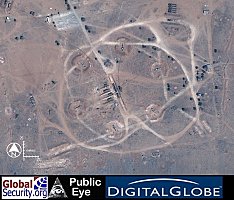 An Russian-build SA-2 surface-to-air-missile site, defending the storage area and underground facility. |
|||
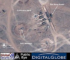 Close-up of the SA-2 SAM site with Guideline missiles on launchers, Fan Song Radar, and Control Vans. Cable are visible running from the command van to the launchers. |
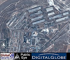 Overview of the Al Safir chemical weapons plant. Expansion took place between 1987 and 1995. |
|||
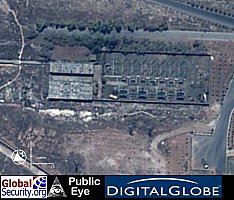 This high-voltage sub-station is an indicator of the presence of activity requiring a large volume of electricity. A normal warehouse complex would not require this much energy. |
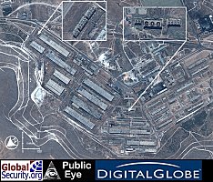 These forced-air cooling towers also indicate the presense of a an industrial process requiring the disposal of waste heat. Chemical processes for nerve agents produce highly unstable intermediates that react explosively with water, steam-heating and water cooling must be replace with special heat-exchange fluids and heating oils that require the use of cooling towers rather than steam vents. |
|||
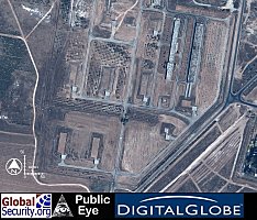 The co-location of munitions storage igloos within the security perimeter of the processing facility is an additional indicator of the Chemical weapons nature of this plant. |
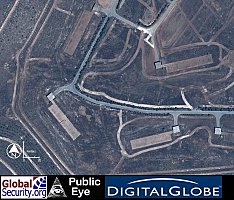 The lower storage igloos were added sometime between 1995 and 2002. |
|||
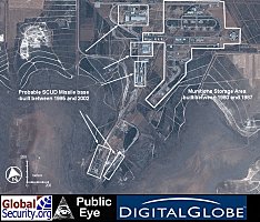 The munitions storage area on the right was built sometime between 1980 and 1987. The buildings on the left are probably associated with SCUD missiles deployed underground and were built after 1995. |
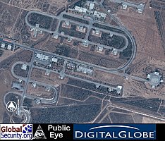 These storage igloos are located at a separate facility, which was build between 1980 and 1987. |
|||
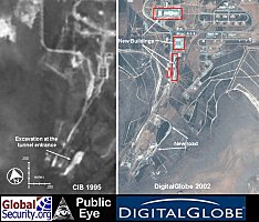 Between 1995 and 2002 an Underground Facility (UGF) was built as well as above-ground support facilities, possibly to house SCUD-D missiles Syria reportedly acquired in 19XX. |
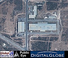 These buildings were built after 1995 and are probably associated with SCUD missiles housed underground. The large building measuring 30 x 130 meters. |
|||
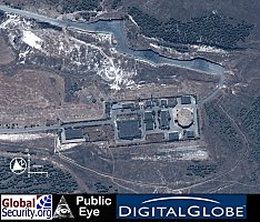 A probable command and control facility, located near the tunnel entrances to an underground facility. |
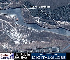 The Tunnel entrances are protected by the box canyon walls, from direct attack from precision-guided munitions. Each of the three tunnel portals is more than wide enought to accommodate the Soviet-build MAZ-543 transporter for the SCUD missile. |
|||
| Help Support Our Work :: Home :: Sitemap ||| WMD :: Military :: Intelligence :: Space |