Vincenzo
Maria Coronelli
(1650-1718)
MAPS
|
|
 |
 |
 |
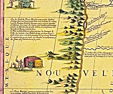
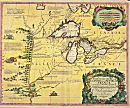
| Coronelli's Map of the
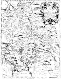
Great Lakes, 1688 Vincenzo Coronelli's 1688 map of western New France is the most
accurate general portrayal of the Great Lakes on a printed map in the seventeenth century
and is an excellent fusion of the many explorers' manuscript maps received while he was
cartographer to Louis XIV. Ordinary and bizarre activities are depicted in the cartouches
in the upper and lower right-hand corners. (National Archives of Canada, NMC-6411) |
Coronelli's Map of the
Great Lakes, 1688 Vincenzo Coronelli's 1688 map of western New France is the most
accurate general portrayal of the Great Lakes on a printed map in the seventeenth century
and is an excellent fusion of the many explorers' manuscript maps received while he was
cartographer to Louis XIV. Ordinary and bizarre activities are depicted in the cartouches
in the upper and lower right-hand corners. (National Archives of Canada, NMC-6411) |
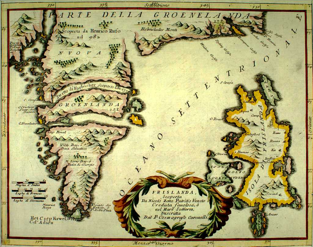
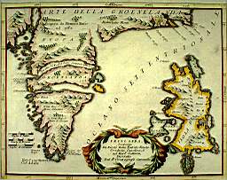
Frislanda.
Venice 1692-94. 22,5x30 cm. Frisland appears as a name of an island south of Iceland
on many old maps depicting the North Atlantic region. In Nicolo Zeno’s book and map
of 1558 it is very prominent. Frisland was probably an amalgamation of Iceland and the
Faeroes and the double of both of them. This map is from Corso geografico universale by
Vincenzo Coronelli and is probably derived from the Zeno map. |
 |
 |
 |
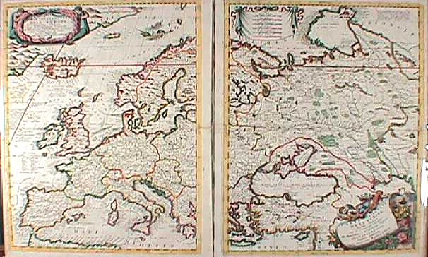
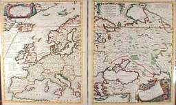
| "Parte
Occidentale Dell' Europa" with "Parte Orientale dell' Europa."
From Atlante Veneto. Venice, ca. 1691 Two unjoined and uncut sheets, each ca. 23 3/4 x 18.
Engravings. Lovely outline hand color. Excellent condition. |
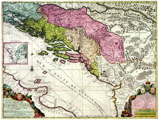
Karta Dalmacije
/ Map of DalmatiaParis Vincenzo maria Coronelli, Jean Baptiste Nolin Paper,
coloured engraving 58.7 x 44 cm Scale: cca 1:500,000
In the lower right-hand corner of the map of the 'Kingdom of Dalmatia' are the coats of
arms of Bosnia, Dalmatia, Croatia and the Republic of Dubrovnik. The engraver's signature
is placed on the lower edge of the map: J(ean) Guerrard... fecit. |
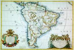
America meridionale
Venise, ca 1691, 58 x 86 cm cote: XXV Amérique du Sud Gén. ca 1691 IV 11.238 CP |
 |
 |
 |
| Map of America, 1688, |
Atlante Veneto, nel quale si
contiene la descrittione geografica, storica, sacra, profana, e politica … dell’
universo. Venice, Domenico Padoueani, 1690.
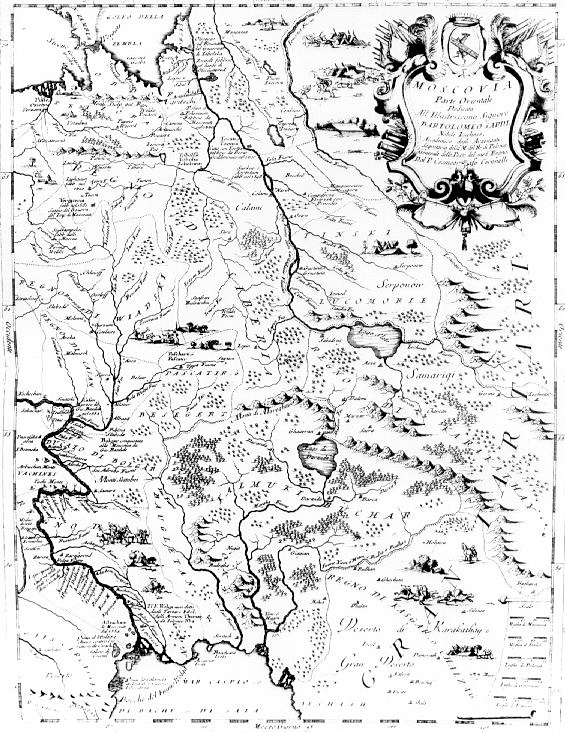
“Moscovia parte orientale ” p. 110. Coronelli was the leading Italian
cartographer of his time, and many of his maps were collected in this work. This map
includes that part of Russia north of the Caspian Sea and somewhat to the
east. |
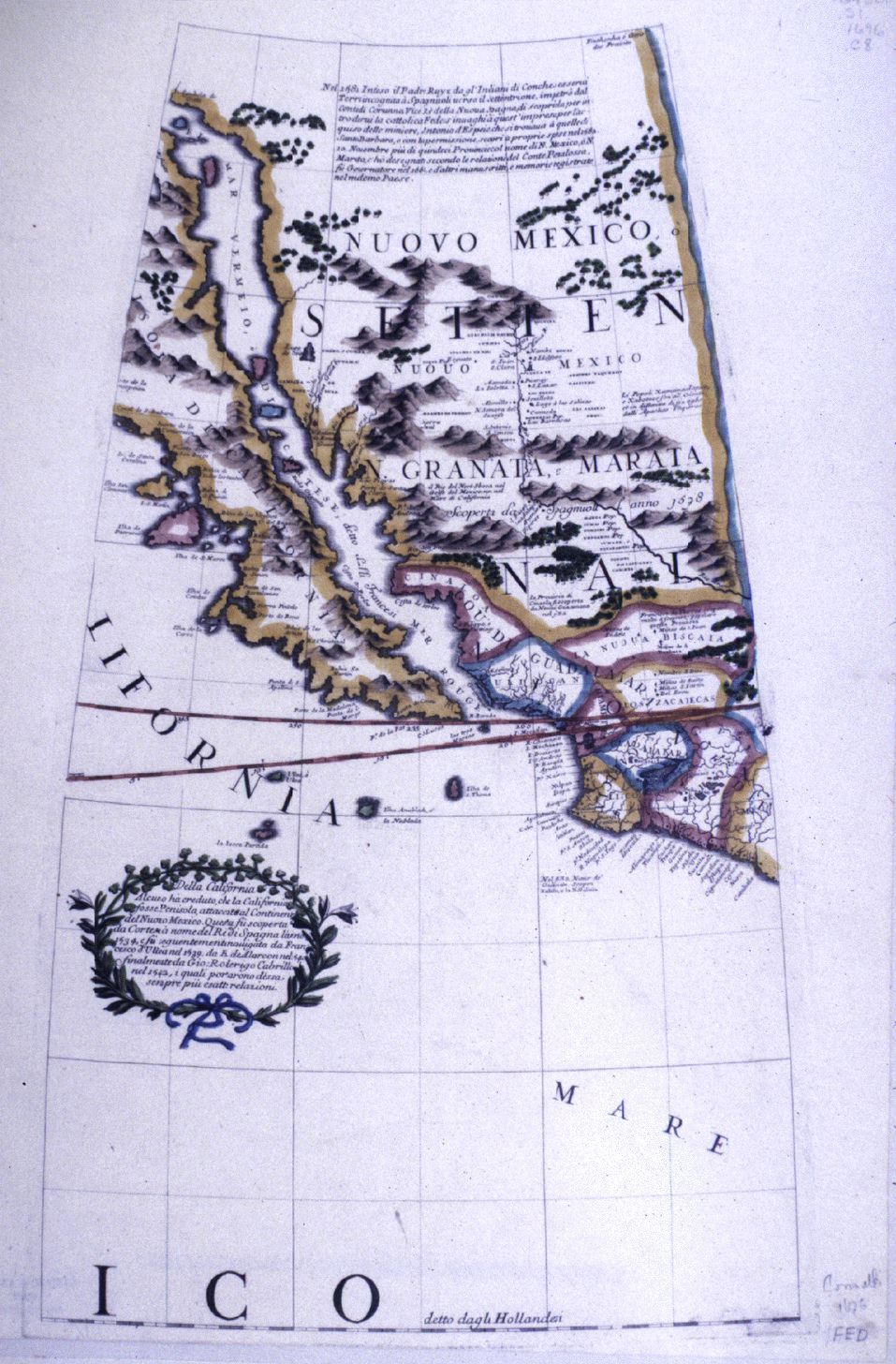
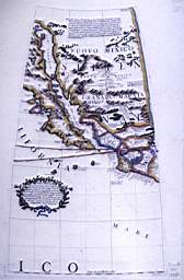
Terrestrial Globe Sheet: the
American Southwest. Venice. 1696. Colored map on sheet 50 x 37 cm. Scale ca. 1:8,000,000.
A globe gore from his Atlante Veneto, 1691-1696. |
 |
 |
 |
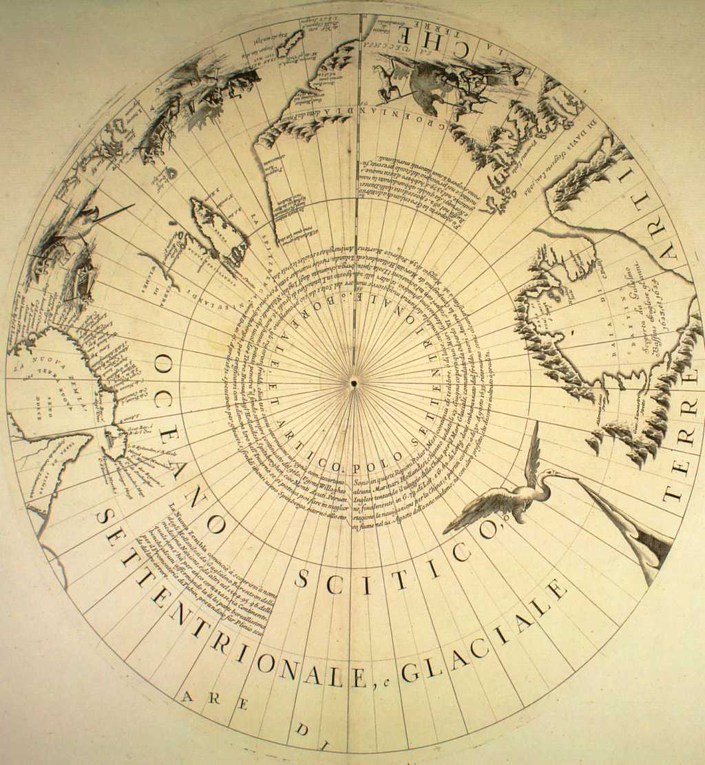
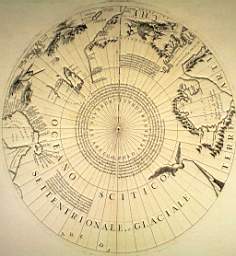
| Terre artiche / Oceano
Scitico, settentrionale, e glaciale. Venice 1692-94. 37x35,7 cm The map is
from Corso geografico universale. It only covers the most northern part of the earth so
Iceland is not on it. |
Epitome cosmografica.
Cologne, 1693.
|
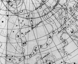
Epitome Cosmografica
Il Giordano, Venezia 1693 |
|
|
|
|
Coronelli Maps in Versione
"Power Point"
Coronelli |